FIRESYNC OPS™
Your Operations Just Got Sync’d
Provides On-Scene Situational Awareness and Job-Aid Tools with Off-The-Grid Capability
To check out the apps for free download here


FIRESYNC OPS™
Your Operations Just Got Sync’d
Provides On-Scene Situational Awareness and Job-Aid Tools with Off-The-Grid Capability
To check out the apps for free download here

-
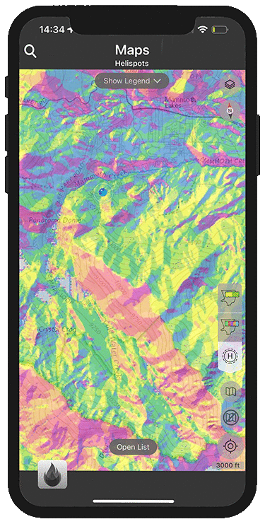
Base maps; off-line topo aerial, street view, slope aspect
-
Add any map layer in KML format
-
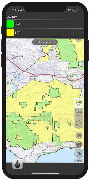
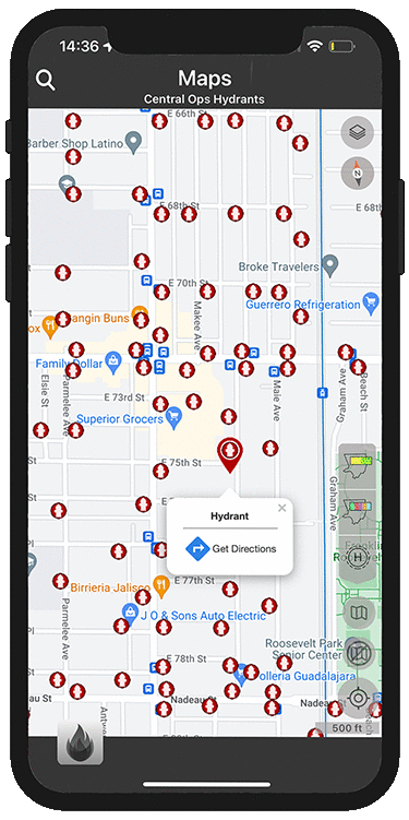
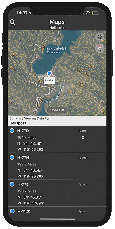
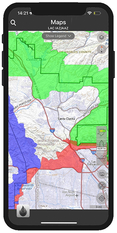
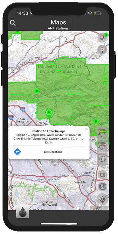
Direct Protection Areas (DPA), fire station boundaries, hydrants, Initial/Auto Action Zones (AAZ/IAZ), mutual aid areas, helispots, target hazards, water districts, repeater, communication zones, hazard areas, utilities
-
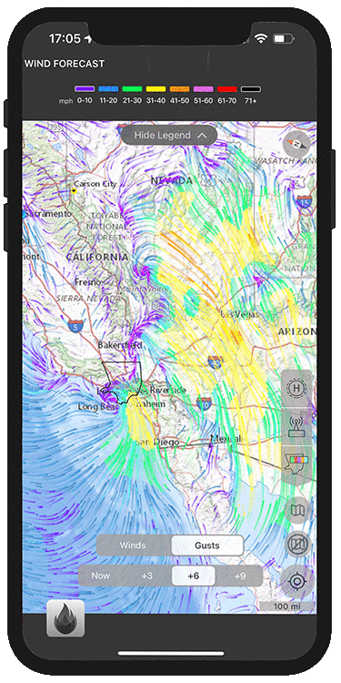
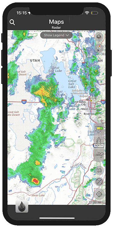
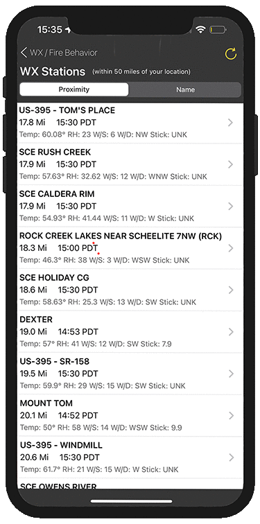
Real-time weather intel with radar, winds and wind predictions

-
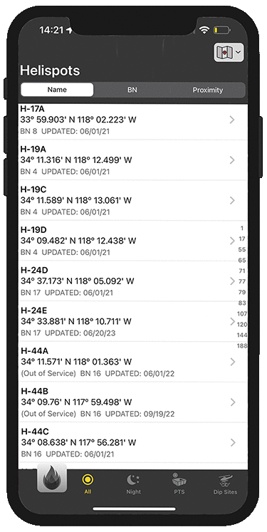
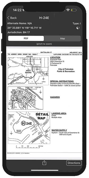
Host a full firectory of predesignated helispots with directions and critical information for air and ground resources
-
List commonly used dip sites or portable tank sites for helicopters

-
Weather forecasts
-
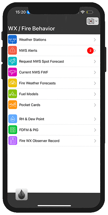
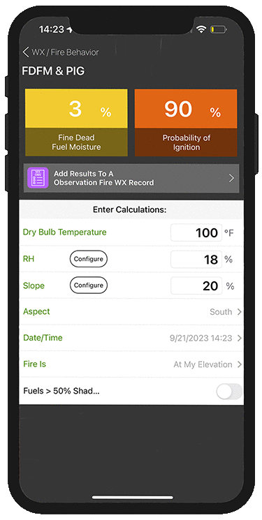
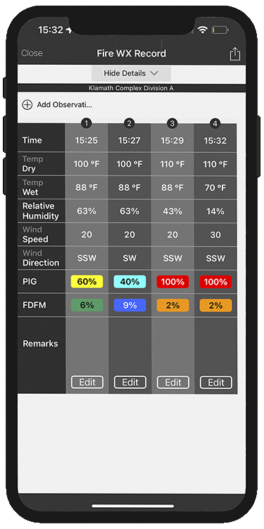
Job-aid tools for Probability of Ignition (PIG) and Fine Dead Fuel Moisture (FDFM)
-
Digital fire weather observer record to see on the line weather trends
-
Post internal fire weather discussions
-
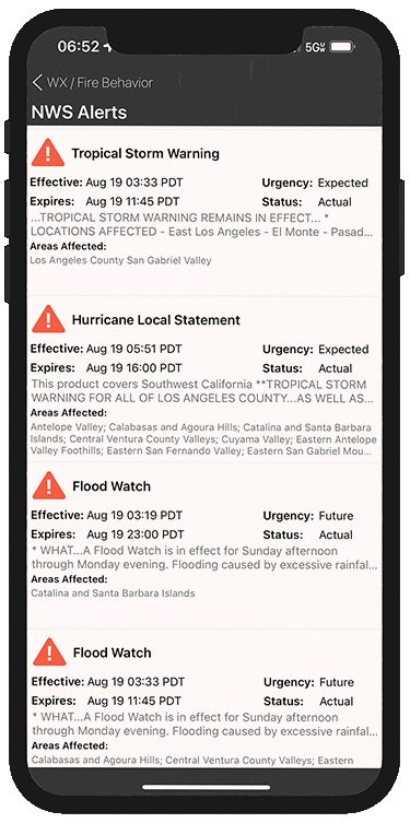
Links to National Weather Service Forecast along with Spot Weather Forecast links
-
Fuel type guide
-
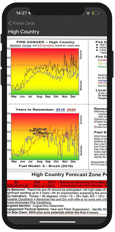
Fire danger rating pocket card for firefighter safety

-
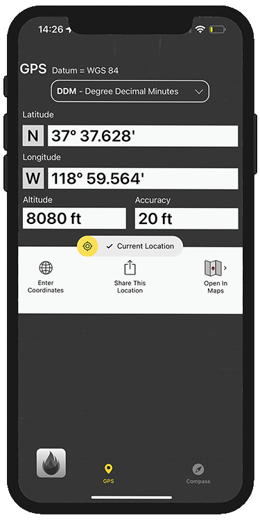
Easy to use GPS, allowing in the field use to easily communicate with air resources
-
Plat incident locations into Mapping Applet for reference to custom maps and base layers

-
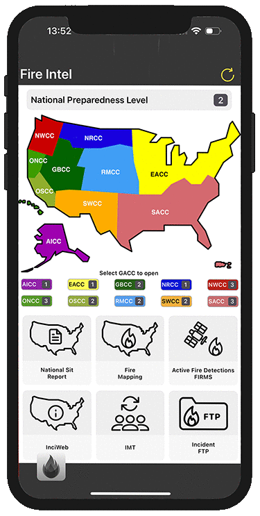
Direct links to the GACCs (Geographic Area Coordination Centers)
-
Direct links to the National Situation Report
-
Fire mapping links
-
InciWeb links
-
Incident management team rotations
-
Link to the NIFC FTP server

-
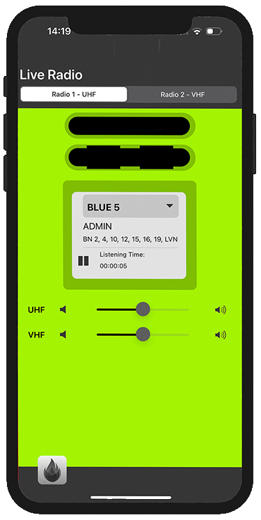
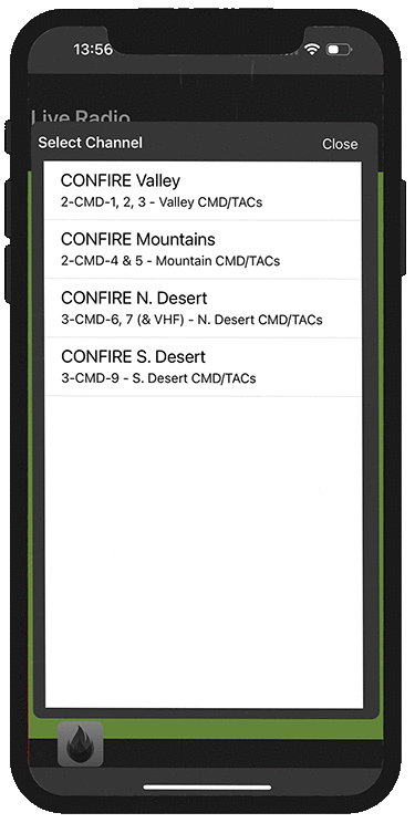
Listen to unlimited live radio channels
-
Scan 2 different radios at the same time

-
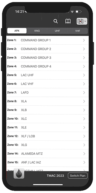
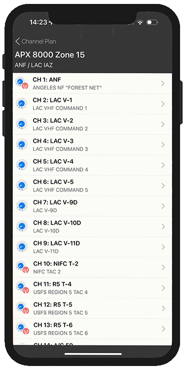
Host unlimited Channel Plans for up to 5 different radios
-
View other agencies Channel Plans
-
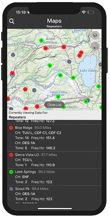
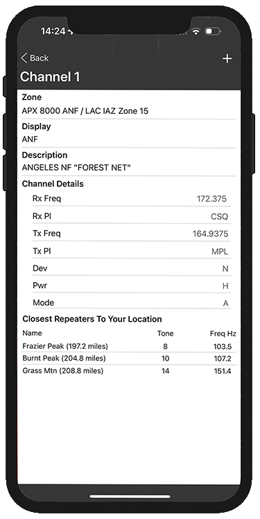
Access repeater information and locations
-
View channel details and frequencies

-
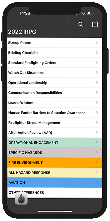
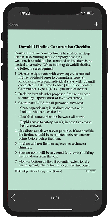
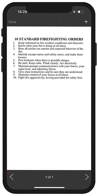
A complete NWCG incident response pocket guide
-
Bookmark areas of frequent use
-
Quickly search and refer to any part of the guide

-
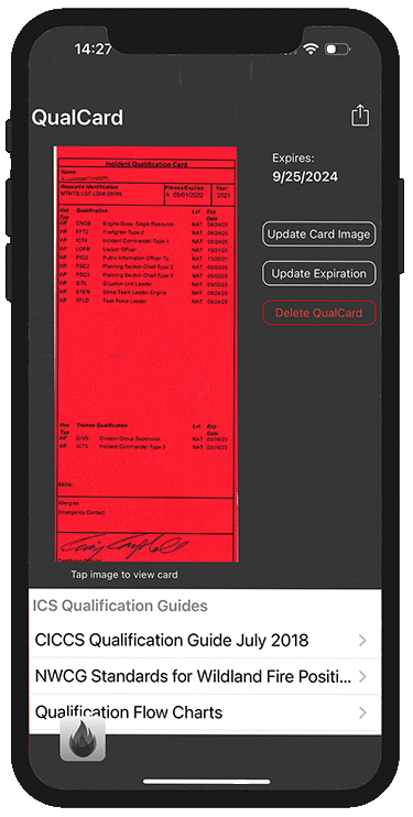
Your personal digital image of your Incident Qualification card to show at check in
-
Links to Federal and State Qualification guidelines
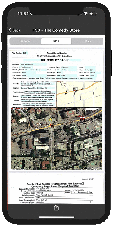
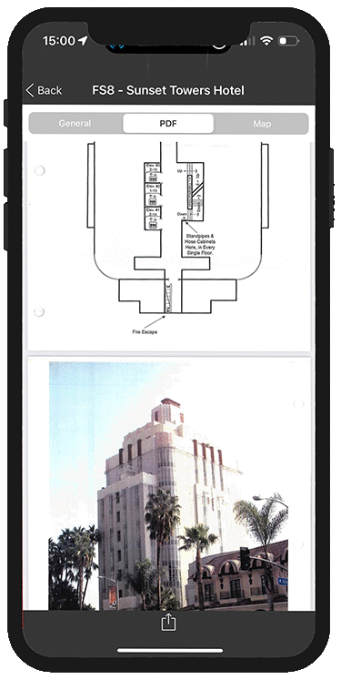
EXAMPLES OF USER-CREATED APPLETS
These are just some of the Applets that our users have created for their organizations
-
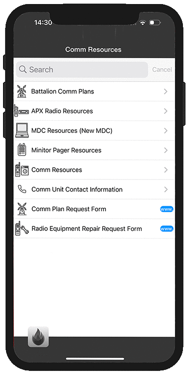
Host all your radio and communications resources and how-to guides in one spot
-
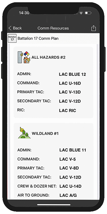
Serve pre-determined comm plans for various incidents
-
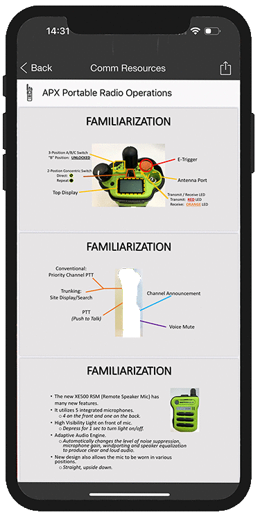
Host radio field repair references

-
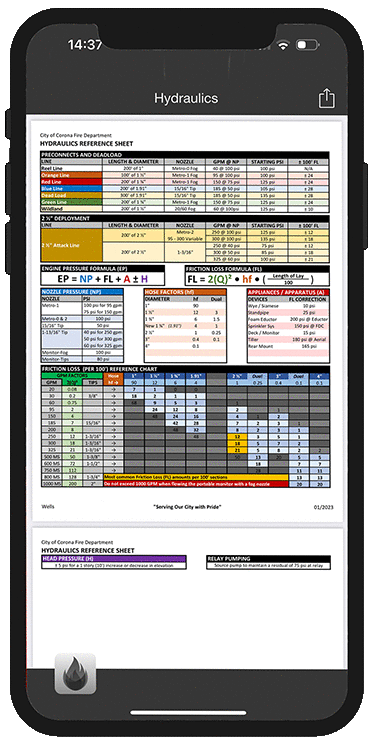
Access to quick hydraulic calculations charts or sheets
-
Give your firefighter and drivers access to hydraulic info for use on-scence or for training


-
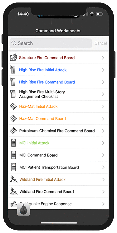
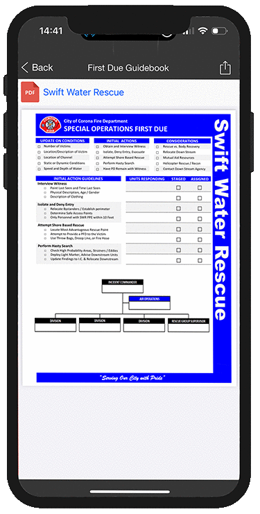
Serve all your command worksheets and checklists for any incident
-
Create an Applet specific for chief officer worksheets
-
Create an Applet catered for first-due personnel or company office checklists

-
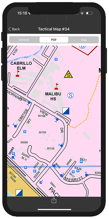
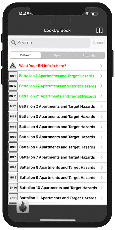
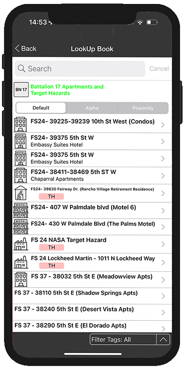
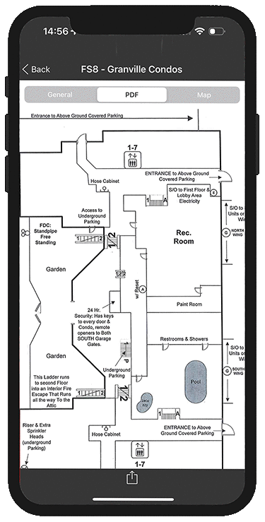
Geographically catalog your maps for high occupancy facilities like apartment complexes and mobile home parks
-
Allows for easy mapping and routing into large complexes

-
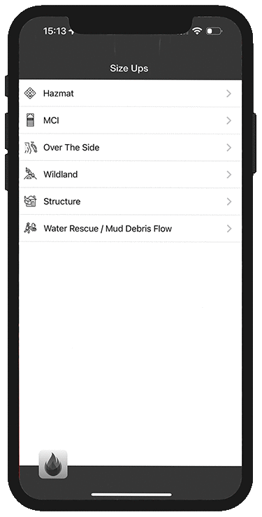
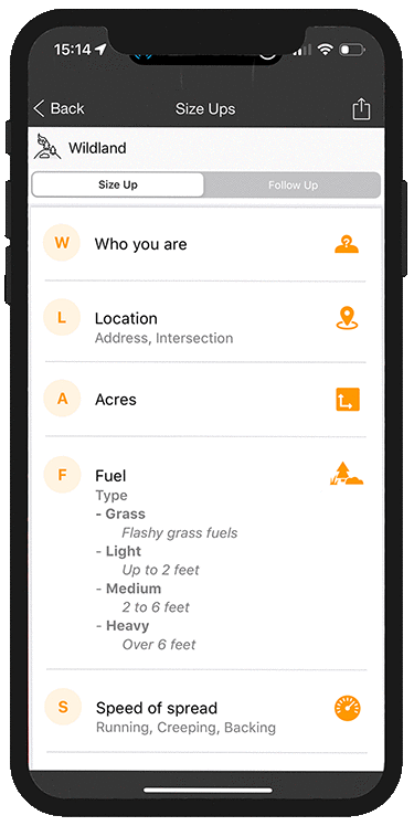
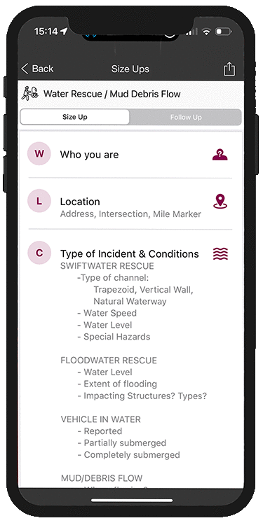
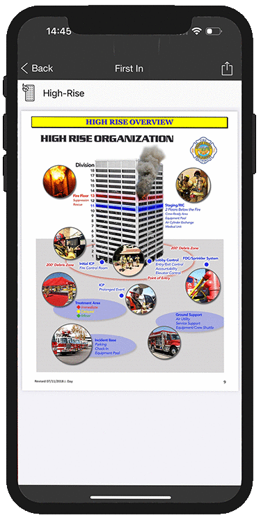
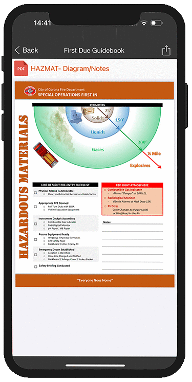
Serve up on-the-scene size up scripts for any type of incident
-
Your own organizations customized size-ups for stucture/wildland fires, HAZMATs, MCIs, and water rescues

-
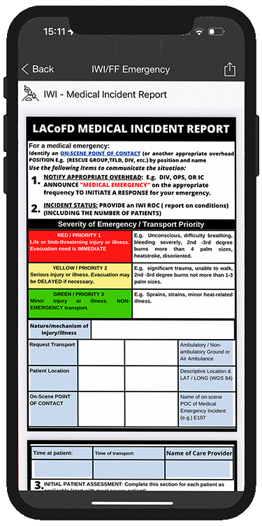
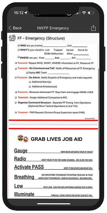
Post your own agencies MAYDAY or IWI procedures for on-the-fire ground reference

-
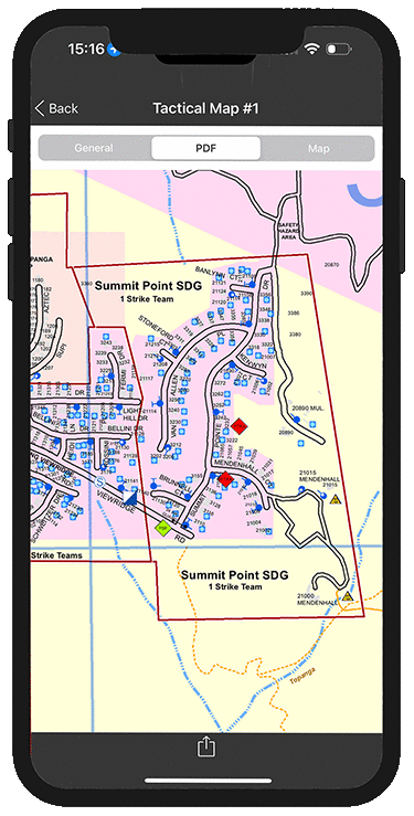
Geographically catalog your structure defense plans for easy off-the-grid access
-
Easily share structure defense plans with mutual aid Resources During Initial Attack situations